Coriva - The accurate UWB Indoor Locating solution
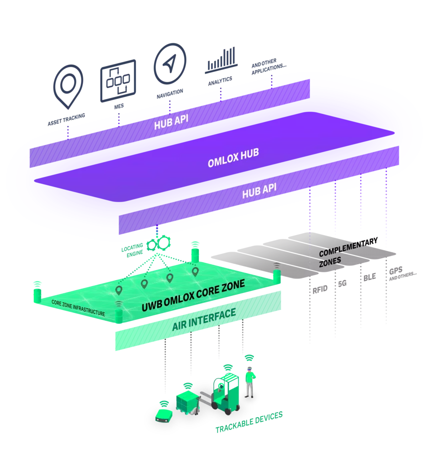
Our omlox certified UWB core zone named Coriva combines Satellites and Tags to provide precise asset tracking and location-based services over omlox Hub API. Coriva is fully omlox air interface compliant and designed to connect with multiple omlox Hubs, e.g. the CorivaHub Lite.
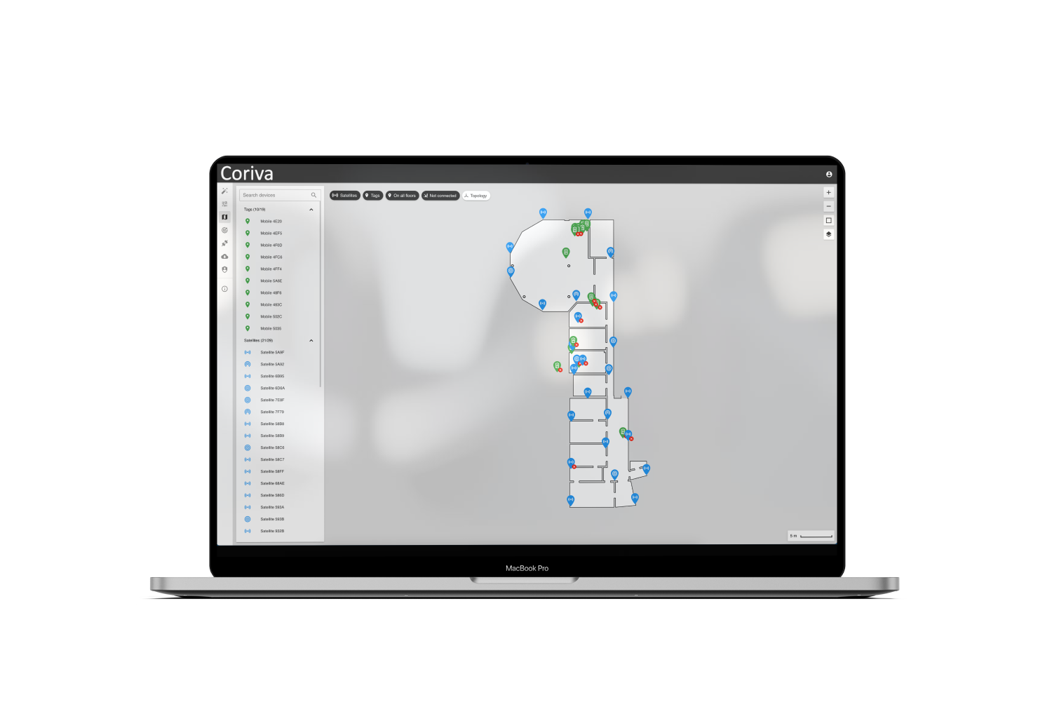
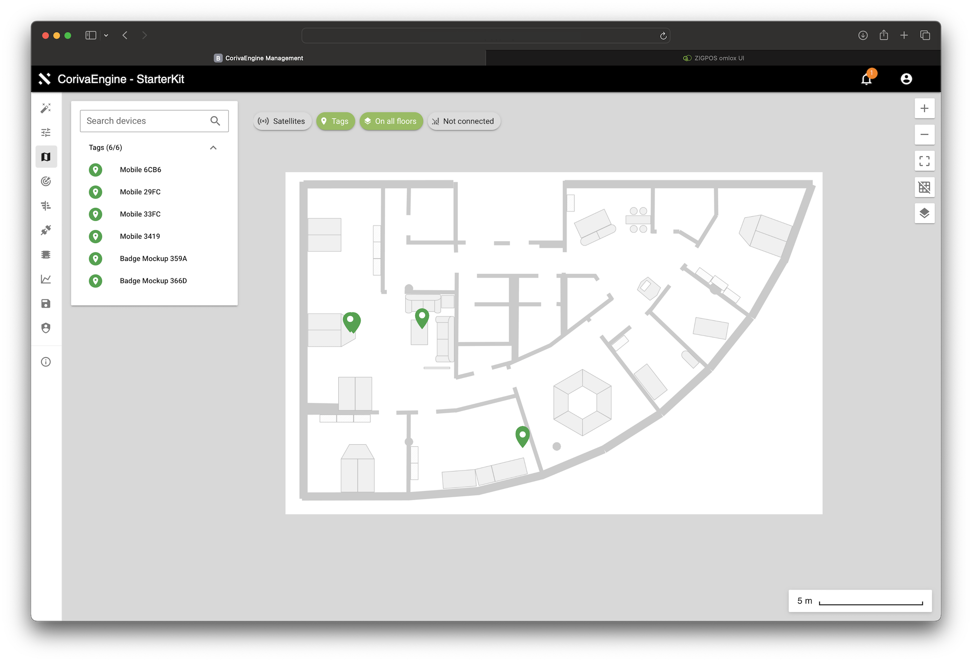
Coriva Engine
The Coriva Engine coordinates the positioning of the omlox Air devices and determines positions probalistically using Monte-Carlo Localization with different locating technologies like Time Difference of Arrival (TDoA)
Tools
ZIGPOS offers a comprehensive range of tools to support every aspect of your RTLS installation. Our tools cover various crucial areas such as Satellite Planning, Accuracy Analyzer, Device Monitoring, and over-the-air (OTA) firmware updates.
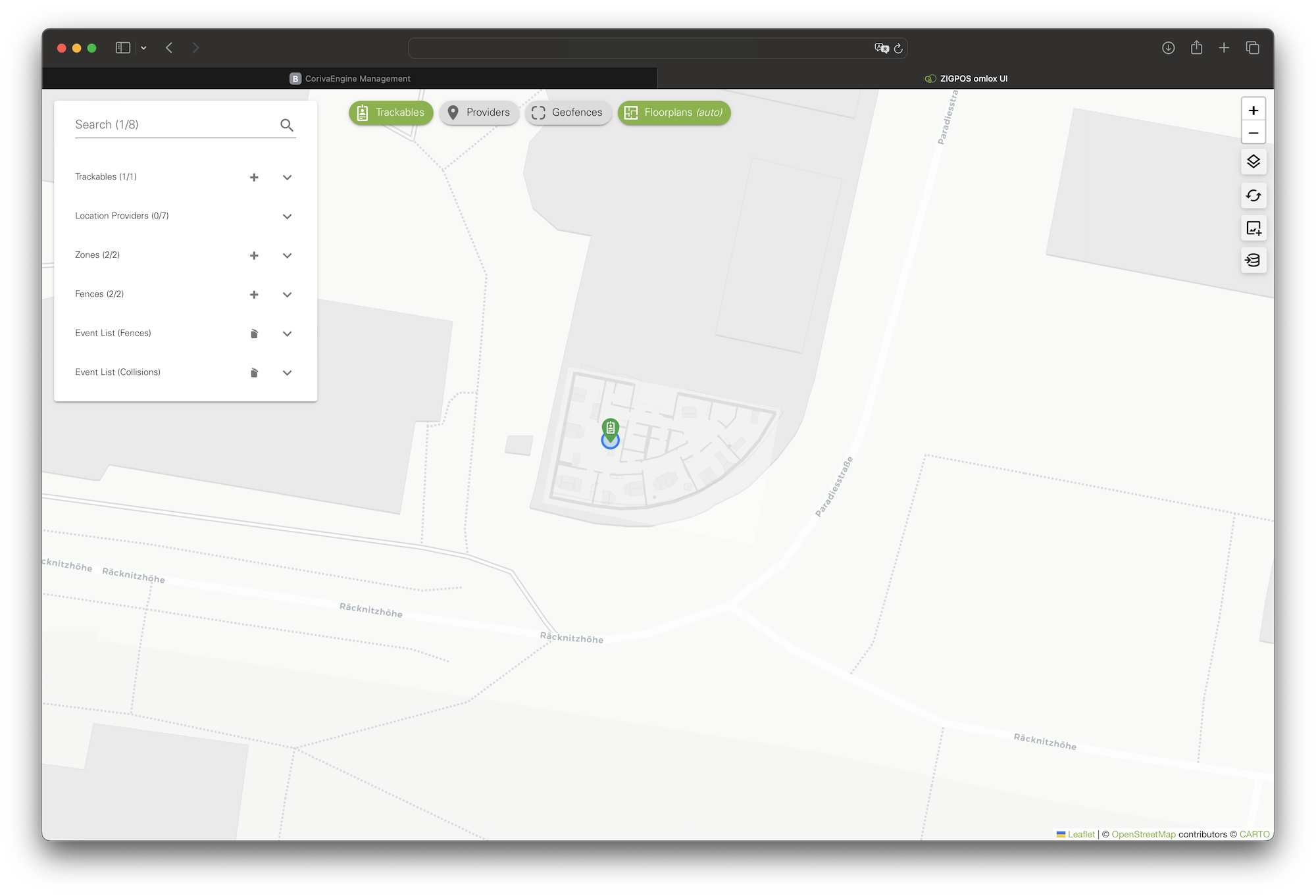
omlox Hub
The ZIGPOS Coriva RTLS provides all location relevant information via standardized interfaces to the omlox Hub. Additionally, a REST API, Websocket or MQTT in standardized formats, such as GeoJSON or EPCIS, are available. This enables easy integration into existing IT infrastructure.
Consulting
Our dedicated Field Application Engineering Team is here to provide comprehensive support throughout your installation process. From the initial stages of defining your unique Customer Success Story to ensuring the optimal placement of satellites, our team will work closely with you to understand your specific requirements and tailor the solution to your needs.
Setup
ZIGPOS offers an intuitive RTLS Setup Tool designed to simplify the configuration process of your Real-Time Location System. With this tool, you can easily set up local coordinates, manage devices and maps, and define geozones within your RTLS area. By georeferencing the RTLS area, the tool enables you to calculate global coordinates, facilitating seamless integration with other systems and enhancing interoperability.
Support
At ZIGPOS, we understand the importance of providing comprehensive support throughout the lifecycle of your real-time location system (RTLS). Our support offerings cover both pre-launch and operational phases, ensuring a seamless and efficient experience. From initial consulting to address your unique requirements, to ongoing assistance during operation, we are committed to your success.